

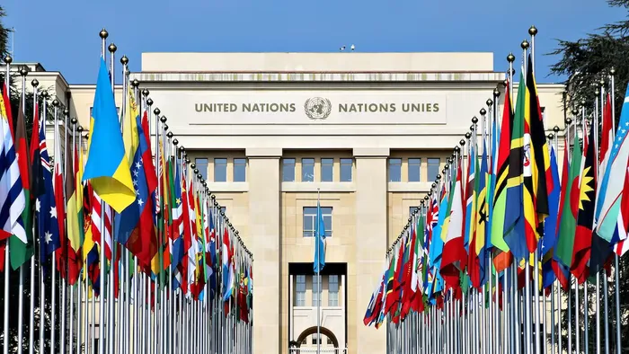
Africa has finally received a major victory in the global debate over how the world is represented. On Friday, September 4, 2026, the United Nations General Assembly adopted the “Correct the Map” resolution.
The resolution was sponsored by Togo on behalf of the African Group. It received 164 votes in favour, while six countries abstained.
The United States was the only country to vote against the resolution.
Why Does Africa Look Smaller on World Maps?
For centuries, many classrooms have relied on the Mercator projection. Gerardus Mercator introduced the projection in 1569 for navigation.
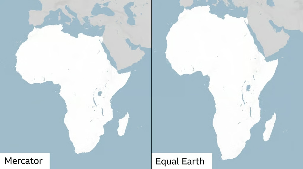
However, the map dramatically enlarges areas closer to the North and South Poles. Consequently, Africa appears much smaller than its actual size.

For example, Greenland can appear similar in size to Africa on Mercator maps. In reality, Africa is about 14 times larger than Greenland.
Equal Earth Projection
The UN-backed resolution promotes the Equal Earth projection. Unlike Mercator, Equal Earth preserves the relative areas of continents and countries. Therefore, Africa appears closer to its true geographical scale.
The projection was developed in 2018 by cartographers Tom Patterson, Bojan Šavrič and Bernhard Jenny. It provides a more accurate way to compare the world’s landmasses.
What Does This Mean for Kenya?
Kenya is part of the African campaign supporting more accurate global representation. Under the new approach, Kenya will appear according to its actual proportion of the Earth’s land area.
However, the change will not alter Kenya’s physical size or borders. Instead, it changes how maps visually represent geographical areas.
The resolution encourages governments, schools, institutions and technology companies to consider more accurate projections.
Is the Mercator Map Now Banned?
No. The resolution is not legally binding. It does not prohibit countries from using Mercator maps. Mercator also remains useful for certain navigation purposes.
Instead, the UN is encouraging wider adoption of equal-area projections for education and other uses.
Why the Change Matters
Supporters say maps influence how people understand the world. For many Africans, the campaign also challenges longstanding perceptions created by distorted representations.
The resolution therefore carries both geographical and symbolic importance. It could eventually change maps used in schools, media and digital platforms.
For Kenya and the wider continent, the message is simple. Africa was never as small as many familiar world maps made it appear.